
Last checked: November 17, 2026
If you walk or ride the White Oak Bayou Greenway near downtown, you’ve met this project. Orange fencing. Detour signs. A switchback up to Studemont. This guide is for trail users, not drivers.
Here’s what TxDOT is building, what it has closed, how to get around, and what you get when it’s done. Closures change often, so check our live trail alerts before you head out.
What the project is
TxDOT is raising I-10 out of the White Oak Bayou floodplain between Heights Blvd and I-45. The project is 1.8 miles long. TxDOT calls it a resiliency project. It does not add car lanes (TxDOT, About).
Why now? TxDOT’s flood gauge and maintenance records show this stretch of I-10 has gone under water 10 times since March 1992 (TxDOT, About).
The project also:
- rebuilds the Houston Avenue bridge so it runs under the I-10 mainlanes (TxDOT, About);
- adds a 26-acre detention pond beneath the raised lanes (TxDOT, January 18, 2025).
Cost: $407.8 million, per TxDOT’s April 2026 public hearing handout (TxDOT handout, April 2026). Webber LLC is the main contractor (TxDOT, January 18, 2025).
Timeline:
- January 8, 2025: work began with lane and ramp closures (TxDOT, January 8, 2025; Community Impact, January 14, 2025).
- April 2026: TxDOT said construction was 38% complete. Phase II was scheduled to start later in 2026. Phase III, raising the eastbound lanes, was expected to begin in mid-2027 (TxDOT handout, April 2026).
- June 2028: when TxDOT expects to finish (TxDOT handout, April 2026). In its June 2026 update, TxDOT said it was looking for ways to speed up the work (TxDOT project updates, June 2026).
What’s closed for trail users
Little White Oak Bayou Trail: Houston Ave to the Castillo Community Center
- Closed since: January 15, 2026.
- Why: work on the I-45 and I-10 connector ramps.
- How long: TxDOT expects it to stay closed through 2028. It may reopen at times during the project.
- Detour: a signed detour is in place, and TxDOT posts a detour map. Follow the posted signs. Stay out of areas with orange construction fencing.
Source: TxDOT trail closure notice (checked November 17, 2026). TxDOT’s detour map sends trail users north to White Oak Dr, east under I-45, and back down to the trail past the Leonel Castillo Community Center. Our alert for this closure has the map.
White Oak Bayou Greenway under I-10 near Studemont
- Status: closed, per our alert. TxDOT’s pages give no dates or end date.
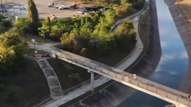
- Detour: TxDOT built a switchback that brings you up to street level at Studemont. Getting back to the trail from there means a busy intersection and weak sidewalk links to the Heights MKT Trail.
Source: our alert (checked November 17, 2026).
Street detours close at night too
As of June 2026, TxDOT listed nightly closures on Studemont St, Taylor St and Houston Ave for bridge and paving work (TxDOT project updates, June 2026). Check Houston TranStar for this week’s closures.
The new path isn’t open yet
TxDOT is building new path segments on the north side of the corridor. As of June 2026, they were not open to the public because of ongoing construction and equipment traffic (TxDOT project updates, June 2026). Don’t use them until they’re signed open.
Open again: the MKT bridge near Studewood
This is the bridge on the Heights Hike and Bike Trail that crosses White Oak Bayou.
- What happened: in late January 2025, equipment and debris from a nearby TxDOT construction project hit the bridge. That portion closed. No repair date was set (Community Impact, February 10, 2025).
- What came next: TxDOT received a bridge condition assessment on April 7, 2025. Materials were ordered in May 2025, and repairs were expected to start that August (our alert).
- Reopened: TxDOT’s June 2026 update says the repairs are complete and the bridge is open (TxDOT project updates, June 2026). Our alert lists the reopening as June 11, 2026. ABC13 reported it after more than a year of closure and repairs (ABC13, June 2026).
The Hogan St bridge at the east end is a separate City of Houston repair, not part of this project. Houston Public Works closed it on February 4, 2025, after finding it needed rehabilitation (Community Impact, February 10, 2025). For its current status, see our trail guide.
What changes when it’s done
Here’s what TxDOT says the project adds for people on foot and on bikes.
- A new shared-use path. It’s 10 feet wide and about two miles long, along the south side of White Oak Bayou. It will connect to the existing trail system and the Houston Avenue bridge (TxDOT, January 18, 2025; TxDOT, Bike and pedestrian trails).
- Where it runs. TxDOT’s April 2026 hearing places it on the north side of I-10 along the bayou, from Studemont St to I-45. It connects to the south side of I-10 at Sabine and Maud Sts (TxDOT hearing, April 2026).
- A small piece of Stude Park. TxDOT’s April 2026 hearing proposed using 0.7013 acre of the park for the path, drainage and bridge supports. That land is now used for drainage. TxDOT says the park amenities north of the bayou won’t be affected (TxDOT hearing, April 2026).
- A better Houston Avenue bridge for walking and biking. The rebuilt bridge gets upgraded pedestrian and bike infrastructure (TxDOT, About).
TxDOT hasn’t said when the new path opens. The whole project is due to finish in June 2028 (TxDOT handout, April 2026).
FAQ
Is the MKT bridge near Studewood open? Yes. TxDOT’s June 2026 update says repairs are complete and the bridge has reopened (TxDOT).
When will the Little White Oak Bayou Trail reopen? TxDOT expects it to stay closed through 2028. It may reopen at times before then (TxDOT).
Is TxDOT building a new trail along White Oak Bayou? Yes. It’s a 10-foot-wide shared-use path, about two miles long, between Studemont St and I-45 (TxDOT). It was under construction and not yet open as of June 2026.
When will the I-10 White Oak Bayou project be finished? TxDOT expects to finish in June 2028. That was its estimate in April 2026 (TxDOT handout).
Is the project widening I-10? No. TxDOT says it does not add vehicle capacity (TxDOT).
Is the Hogan St bridge part of this project? No. It’s a City of Houston repair. See our trail guide for its status.
Where can I check closures before I go? Start with our trail alerts. TxDOT’s Bike and pedestrian trails page and its quarterly updates (latest posted: June 2026) cover the project.
Help us keep these alerts current
We walk and ride these trails too. When a detour sign goes missing or a closure ends early, we want to know. Tell us what you see, and help us push for trail connections that work during construction and after. Get involved.

